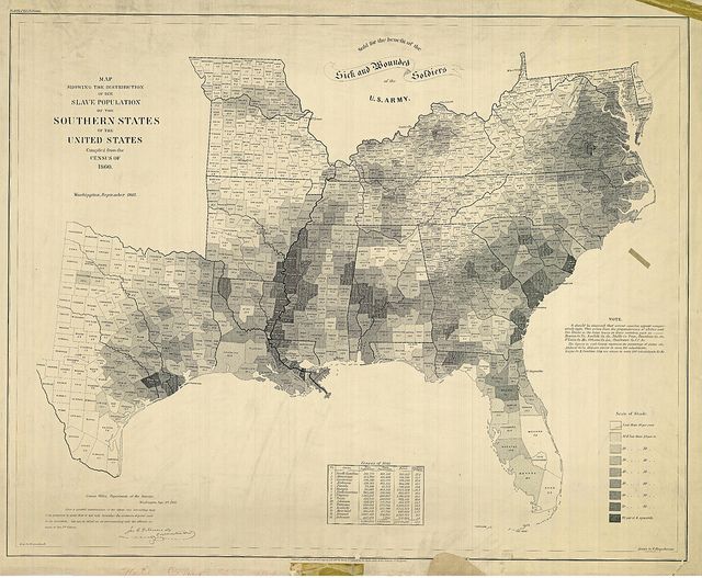
A Map of American Slavery
One of the most important maps of the Civil War was also one of the most visually striking: the United States Coast Survey’s map of the slaveholding states, which clearly illustrates the varying concentrations of slaves across the South. Abraham Lincoln loved the map and consulted it often; it even appears in a famous 1864 painting of the president and his cabinet.